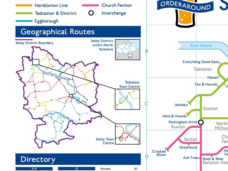
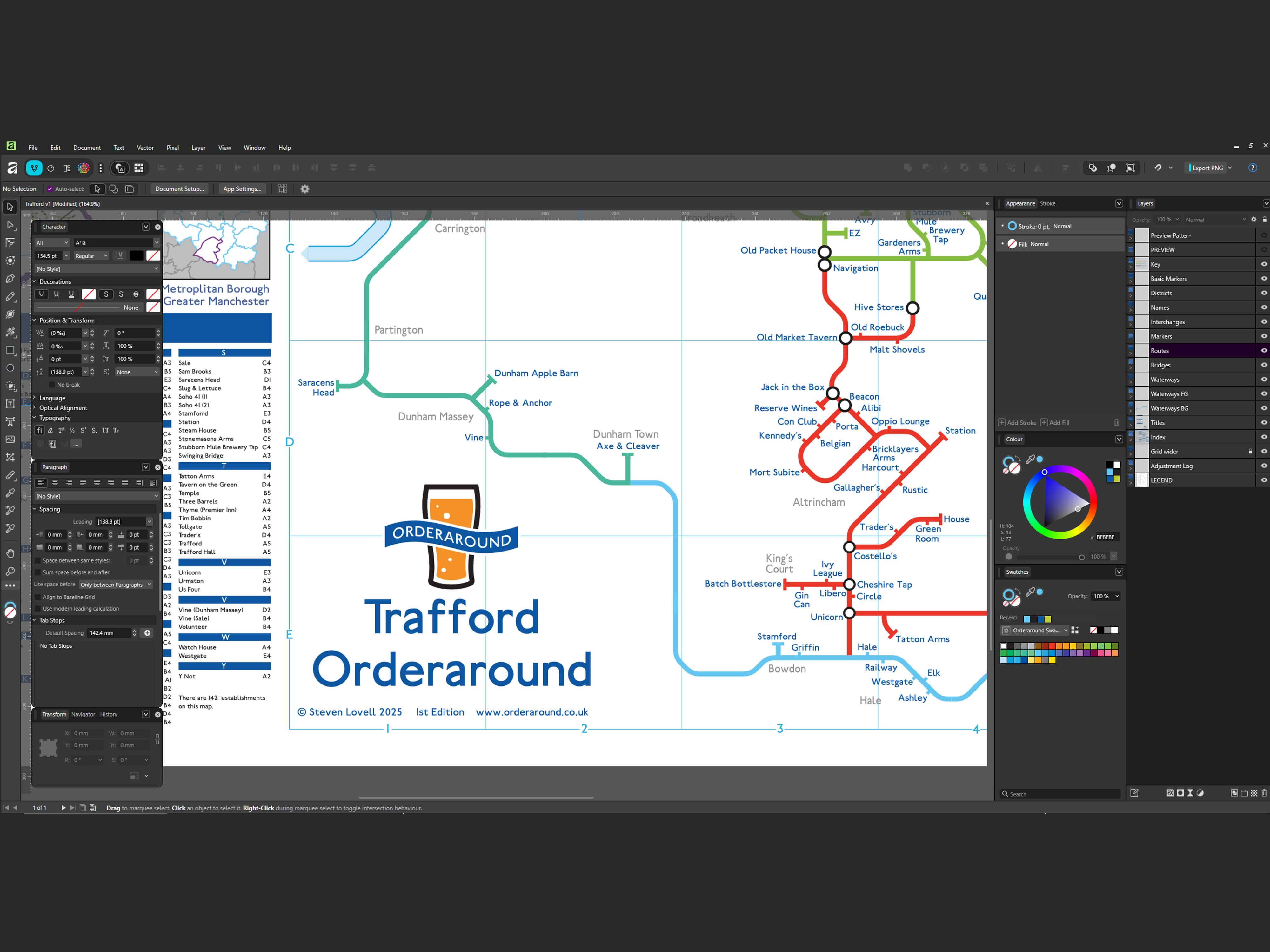
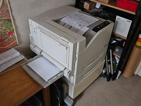
I’ll include some maps on this page, but Orderaround has its own web page and all the maps and updates are best seen and managed over at Orderaround.co.uk.

Origins

I’d always liked the design of the London Underground map and in the mid-90s I saw a hand drawn diagram of Wakefield pubs in Harry Beck’s style. It stuck with me and in 2007 I began work on my own for Leeds. It was a much bigger project than expected and I just abandoned it for a few years. I did all kinds of unnecessary development work to start with. Much of which isn’t covered here. In 2013 I resumed the project. The 5th edition of the Leeds map (2020) has 600 places on it. As of 2022 I’ve made 36 pub maps (and one of crude and sweary words in a rude shape).

A modern version of Harry Beck’s iconic and ingenious London Underground map.
Part of James Somerville’s hand drawn map of Wakefield city centre pubs that spurred me on to make my own.


Early ways of working

My initial way sof working were quite poorly conceived and unnecessary.

I made a bunch of icons for different types of premises. I can’t remember if these were solely for my benefit or if at some early point I’d considered using them in the design.
I contacted Transport for London (TfL) to see if they’d have a problem with any logo ideas I was considering. They weren’t happy about the first two options though.
Plotting premises with Google maps.
One of many iterations of pub plotting on maps.
I had a list of places for all parts of Leeds but this was also quite unnecessary.
This was an early paper version of the Wakefield map.

Improving the Process

The methods used for the first two maps (Leeds and Wakefield) were all over the place and even involved doing things on paper. I devised a more efficient way of working but the maps still require a whole lot of work.

I download an open source vector map for a new area and clean it up extensively so I only have the most basic stuff on it. Then I begin adding markers for premises locations.
After all the locations are plotted, I choose roads and paths that best link them together.
I start the pub map design with a dense area like a town or city centre, adapting the geographic paths to geometric ones.
Getting all the markers, text and paths to fit is quite a challenge and takes quite a while.
After the layout is complete, it’s time to separate out areas into districts and regions for routes and colour them.
After the main map is done, there’s the directory and geographic map to sort out. The map used for plotting the places is repurposed for this. I think it’s nice to see how the geometric map relates to the real geography.
A completed A3 size map.

Promotion

When I’ve just about completed the design I usually like to visit the area I’ve done it for, take a few photos and have a drink or two. I also ask for feedback from local Facebook groups in case anything has closed, opened or changed. Ideally, the local newspaper will then feature an article on it. With any luck there’ll be a short flurry of interest but sales soon die down. There may be a trickle of random purchases through the year and then I just have to hope that a few more orders will come in before each Christmas.

A couple of photos (Selby in this case) for my website and for any newspaper to use.
One of the rare times the map was used in an article but none of my photos were.

Some maps are more popular than others and because some get no interest at all, it can be a gamble to spend a lot of time on making one if it turns out to be far from worthwhile. Leeds has been the most popular by a long way. Durham seems to have been the least popular, but Newcastle has been the most surprisingly disappointing.

Sample Maps

Leeds Map (5th Edition)


Leeds City Centre & Otley Run map (15th Edition)


The Sweary “Vulgarismap” aka “Longdong Pube map”

CAUTION: Crude sweariness ahead.


Notes

On the large maps (and sparse smaller ones) I include notes to help people understand some of the design choices:

Most instances of common prefixes and suffixes such as “The”, “Inn”, “Bar” and “Hotel” have been omitted for clarity.

Directions and distances between pubs and bars or geographic areas should not be directly inferred due to localised scale distortion.

All routes follow a recognised geographic road or path etc, but this should not be used as a basis for transport routes and they may not adhere to locally recognised pub crawls.

Alignment to one side or other of a route does not necessarily correspond with the side of the road an establishment is on.

Many hotels, cafés and restaurants have been included on the map where there appears to be a welcoming, comfortable and easily accessible space for having a casual drink without food or other services.

Whilst generous evaluation criteria have been applied, assessment and inclusion of all establishments is discretionary and subjective.

With some limited exceptions, the following types of licensed premises are generally not included on this map:

• Bars within most leisure or cultural facilities such as cinemas, casinos, theatres, sports venues, art galleries and museums etc.
• Private members clubs such as Social Clubs, Working Men’s Clubs, Sports Clubs and politically affiliated clubs.
• Gentlemen’s clubs and XXX related establishments.
• Paid/ticketed entry entertainment venues.
• Student Union bars.
• Bottle Shops.
• Karaoke bars.
• Nightclubs.

Few maps have enough free space to include any notes.

Leave a Reply

Your email address will not be published. Required fields are marked *